|
| |
|

|
Boco
|
 |
who was once King for a week.
Jan 2001
time: 00:36
|
|
@Eivind. The current version is very close to beta, so I'm reluctant to revise v1 at this time. There wasn't enough room to post it at the Geocities site. These links may work; they are from my Apolyton upload directory:
@Merc. CityPref works well!
Version 2 is a major upgrade with a lot of effort to improve both gameplay and historical accuracy. Infantry has been upgraded to allow for Murray-style slugfests (e.g. Gaza I and II), but your best bet is a carefully planned Allenby-style juggernaut (e.g. Gaza III and Megiddo).
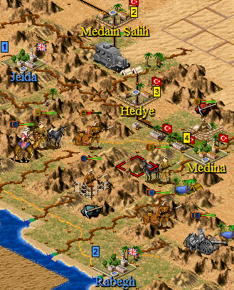
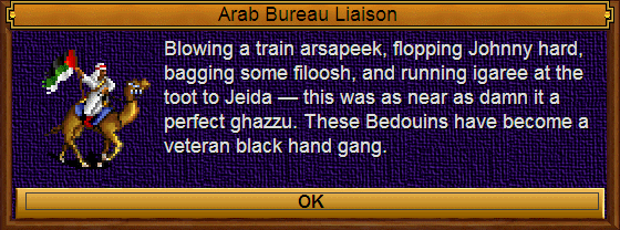
Arab and Sanussi fronts are fairly similar to v1, but with a few tweaks — individual Bedouin tribes, trains, nastier potential for Saudi vs Hashemite infighting, and a Darfur theater.
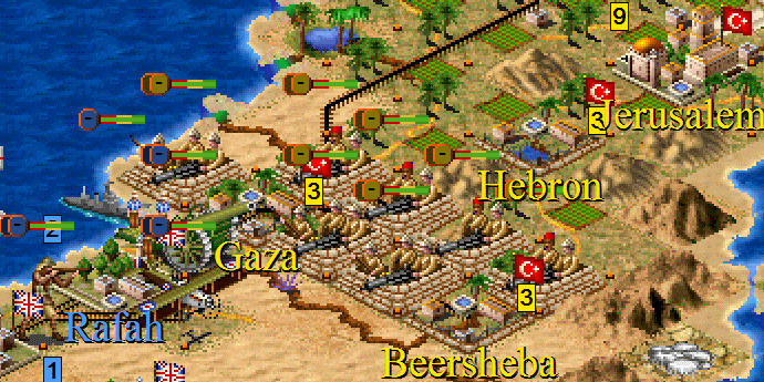
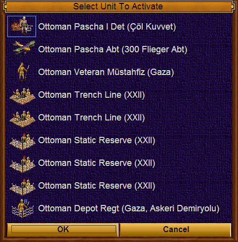
Here's a screenie or two from the latest Alpha. It's Sept. 1917. Allenby has massed 3 cavalry divs, 5 infantry divs, and 5 batteries of heavy artillery against the heavily entrenched XXII, XX, and III Turkish corps. Can he give the Allies Jerusalem for Christmas? It's a challenge, but with careful use of all arms at your command, it can be done!
 Attachment: jerubyxmas.gif Attachment: jerubyxmas.gif
This has been downloaded 198 time(s).
Last edited by Boco on 27-06-2005 at 08:22
|
|
| |
|
|
|
Allard HS
|
|
wow, boco, that really looks great!
what are you going to do with that "darfur theatre"? Are you going to add another map?
|
|
| |
|
|
|
Boco
|
|
who was once King for a week.
Jan 2001
time: 00:36
|
|
Thanks Allard. Kudos from a master are always welcome,  but the art is a compilation of work by Fairline, Catfish, curtsibling, Sarstock, and many others. but the art is a compilation of work by Fairline, Catfish, curtsibling, Sarstock, and many others.
EAv2 has four maps: Near East Theatre, Arab Tribes, Order of Battle, and Political+Secret. Darfur is on the Arab Tribes map. The terrain gfx are not yet finalized. Wonder where I can find some terrain for Darfur? 
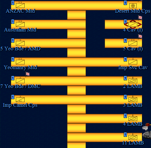
Here's a screenie of an OOB map section. The gold bar leads to transport sites under Matruh, Cairo, Kantara, Gaza, and Jaffa. The idea is to move your units to one of these sites and hop to map0. I tried your idea of labels at these sites, but the city present flag messed up the transport flag. Is it possible to hex edit a square (on map2) to have a transport site, a city label, and no city present? How difficult is it to change the continent number on ~100 squares? I'd like to get the 'go to' command to work on map2, but after all my mapediting, there are multiple continents for one contiguous mass.
One nice feature of multiple maps is that you can specify units that can only be built on a particular map. I use that to allow Bedouin building only on the Arab Tribes map.
Attachment: dmcoob.gif
This has been downloaded 172 time(s).
|
|
| |
|
|
|
AGRICOLA
|
|
Canadian bush & Florida
Feb 2003
time: 00:36
|
|
quote:
Are they silly questions? |
Not at all. I don't know the answer to
quote:
Is it possible to hex edit a square (on map2) to have a transport site, a city label, and no city present? |
Mercator's hex edit compendium is excellent for FW and MGE but only parts of it (with minor adjustments) can be applied to TOT. I'll take a shot at this but right now I don't even know how TOT stores multiple maps. Can't promise to deliver this baby.
quote:
How difficult is it to change the continent number on ~100 squares? I'd like to get the 'go to' command to work on map2, but after all my mapediting, there are multiple continents for one contiguous mass. |
This is time consuming unless there is a utility that can do it quickly. I can do if you give me instructions as to what you need done and the map.
|
|
| |
|
|
|
Mercator
|
 |
Sorekara no Nanimo
Jan 1970
time: 06:36
|
|
quote:
Originally posted by Boco
Is it possible to hex edit a square (on map2) to have a transport site, a city label, and no city present? |
I think it should be. But transport sites are stored in more places than just the map, so you need to be a bit careful with them or you'll crash ToT...
Try this... This will only work if all cities on map2 are just labels though...
- Place cities on the squares that need labels.
- Use CivEngineer to remove the city present flag from all squares that have the city present flag (on map2).
Note: This would also affect transporter sites and airbases! If you still have some of those on the map too, either remove them first or use a different way to "mark" the squares that need to be adjusted. E.g. put units in the cities if there aren't any units elsewhere on the map and then use the unit present flag instead, or change the terrain type under those cities (before you build them) to one that isn't used elsewhere on the map and then use that to identify them in CivEngineer.
- When you go back to ToT, the cities will have become "invisible" (except for their names). You can now place the transport sites as usual.
quote:
How difficult is it to change the continent number on ~100 squares? I'd like to get the 'go to' command to work on map2, but after all my mapediting, there are multiple continents for one contiguous mass. |
I think the latest MapCopy can help with that. Are you using land mass numbering "tricks", or do you just want to restore the land mass numbering to what it should be?
I think the following would work:
- Export the map through the ToT Map menu.
- Open the map in your map editor, Analyze it and then save it... If you want to play with the numbering, edit the map first so that you get different landmasses for each area that needs a different number.
- Use MapCopy to import just the land mass numbers for that one map back into your savegame.
|
|
| |
|
| |
|
| |
|
|
|
Boco
|
|
who was once King for a week.
Jan 2001
time: 00:36
|
|
quote:
Originally posted by AGRICOLA
but right now I don't even know how TOT stores multiple maps. Can't promise to deliver this baby. |
As far as I can understand, for map data block 2 each map is stored in a continuous block in the organization described by the Allard/Merc doc. They're spread out from each other by a sizeable offset that contains a little info and a lot of 00 bytes. Within this map data block 1, I think the only clue to map location is the continent ID: 1-64 = map0, 65-128 = map1, etc.
I believe this represents 0,0 of map0.
code:
0A 00 00 01 02 00
It's ocean, unimproved, outside of any city, ocean #1, known only to the white civ, and a fertility of 0 (?).
Does Catfish have ToT hexing info anywhere on his site? I know he's very familiar with it.
|
|
| |
|
| |
|
| |
|
| |
|
| |
|
| |
|
| |
|
|
|
Sarsstock
|
|
Well I'd love to take a crack at the icons so needed, though I fear I might not be as good as Curt is at making spectacular new ones.
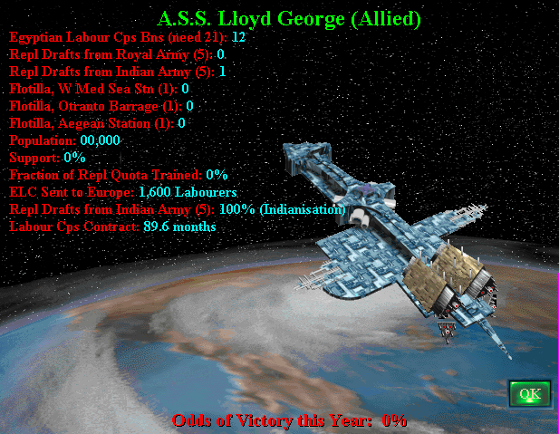
As for the alternate to the spaceship, my only suggestion would be some sort of photograph or painting or other piece of artwork featuring an army travelling by foot, by rail or gathering for transport at a port. The image would be broken up in Photoshop perhaps, and as each spaceship improvment is built a new element will be added to the artwork to represent whatever has been added. Such as a new train car full of supplies added to an image of a train parked at a railyard, or a small freighter loaded with supplies being added to an image of a ship convoy gathering in port.
I hope that idea makes at least some sense as its the only thing I could think up. I remember I had made a similar sugestion to HT for Gold Gultch.
|
|
| |
All times are GMT. The time now is 05:36.
Apolyton Time is 00:36. |
top of page
|
|
|
Forum Rules:
You may not post new threads
You may not post replies
You may not post attachments
You may not edit your posts
|
HTML code is ON
vB code is ON
Smilies are ON
[IMG] code is ON
|
|
|
|
|
|





 27-06-2005 08:11


 No tricky continent numbering needed on this map.
 Top that Exile.
 Let me learn a little more, then decide whether it's worth the cost.
 My brain's beginning to fry.

 I created events to turn these cities into ocean (0 shields). As Allard discovered, the cities aren't razed, but there is a deficit of shields. The affected units were mostly disbanded, but @SUPPORT pops up for every one. In one particularly bad month, there are 36 withdrawals to click "Zoom" or "Continue". That might send a player ballastic.
  If you don't have time, I'll hex edit by hand.
 Attachment:
 I won't have time till tuesday evening at least... I can't even check if you got the latest CivEngineer version. Explorer hangs when I right-click... Oh wait... No I don't think that's the last version... Not sure where I posted that one, or if that'll fix the problem, though..

 After 3 July, I made major edits to map2 (and Events.txt) to ensure that goto commands worked well.

 Attachment:
 |
|