|

|
Eli
|
|
Israel
Jul 2000
time: 07:25
|
|
I'm for a pre-made region and not the blank one.
|
|
| |
|
|
|
Adagio

|
|
quote:
Originally posted by vovansim
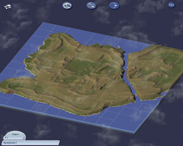
Well, I read the tutorial on creating regions with an elevation map in Photoshop by Mr. Quigley ( ), and decided to try it out. The result is attached. Looks pretty, but also like a very mean terrain. Probably not good for this particular game (although I made a city grid specially for it - no large citis, only small and medium), but if any of you want to try it out, lemme know. ), and decided to try it out. The result is attached. Looks pretty, but also like a very mean terrain. Probably not good for this particular game (although I made a city grid specially for it - no large citis, only small and medium), but if any of you want to try it out, lemme know.  |
Looks great, though I didn't know you could change the grid... how do you do that?
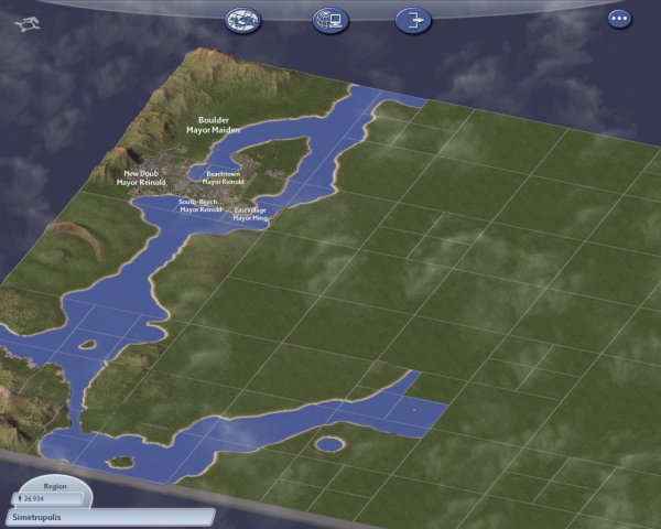
If we use a pre-made world, I vote for New york and this one
John-SJ >> Sorry, missed that one, but it seems like most are for a pre-made map anyway... so everybody, cast your vote for a pre-made map (or upload a picture of yours, if you have one)
|
|
| |
|
|
|
vovan
|
|
quote:
Originally posted by ADG
Thx for the link... though I can't get the map-part to work. When trying to load the map picture, nothing happens when pressing ok (the open file dialog box is still open, and I can still press ok)... when double clicking on the file, the dialog box closes, but nothing happens... Isn't the animations supposed to stop (to show it's working) or something? |
Yes, it is supposed to change the the same screen that pops up when you load a city - it would show the chunk of land, and say "Creating city" on top, or something like that. It also takes a horrible amount of time. On my Pentium IV 1.7GHz, it takes a little over five minutes.
I don't know what your problem might be, because if the dimensions are not right, it tells you so... Maybe you didn't convert the bitmap to grayscale before trying it?
|
|
| |
|
|
|
vovan
|
|
quote:
Originally posted by Osweld
Maybe there are better tools for it in photoshop, but using paintshop I can't even begin to imagine how I could reach the same amount of detail that the pictures in the tutorial have. |
Oh, you are right about that. I can't imagine making the sort of detail in the tutorial, either. But hey, I don't mind, after all I am not an artist, and my name isn't Quigley. (No offense meant, that name always cracks me up... Ocean Quigley... *snicker*). Any ways, if you are having problems with Paintshop, there is a thread on sc4ever, where the guy explains how to customize your tools in it for better results. Read it and see if it is any help (in fact, I rehauled my photoshop tools by analogy and that helped a great deal.):
quote:
Originally posted by GP1183 in Region Editing Guide thread on sc4ever.com boards
Although they do have a Knowledge Library now on the topic, Heres an expansion. If you have Photo Shop, too bad, this only MIGHT apply to you. Paint Shop Pro Users, LISTEN UP!
I made a file called "Base" and its a .psp file. It has two layers, one for the topography (the terrain), and another for the sea level at 40% transparency (for the sea) as described in the tutorial. Now what it doesn't tell you is how to set up your tools. I configured mine to act almost just like a terrain editing tool in SC4. Theyll be labeled and described below.
Airbrush: Shape- Round; Size- 50; Hardness- 0; Opacity- 40; Step- 30; Density- 100.
Pick a high color value, something like light grey. Put it on an area of black, which should look blue if you set it up right. Now what happens when you click is a "terrain raise". Itll act like the Steep Hill tool in SC4. Itll raise the color, and eventually get to the selected value. This is helpful when making hills, Mountains (make the brush smaller or bigger), or Lakes/Rivers (pick a color with a value below 83.
Smudge: Shape- round; Size- Any; Harness- 23; Opacity- 57; Step- 1; Density- 100
Use it to make Mountains, Volcanoes, anything to do with Large, Craggy surfaces. Smoothen terrain, and anything you want.
These 2 tools can be adjusted to do anything. Mess around, and when people ask "hey, how'd you make that kickass terrain?" say "GP1183's Region Editing Guide baby, yeah!"
|
|
|
| |
|
|
|
General Ludd
|
 |
Minion of the Dominion
Aug 2001
time: 05:25
|
|
1. San Fransisco
2. Blank Water map, with an all same-sized grid.
3. Maxisland
(Edited to change my vote)
Might be a good diea to alter the grid to just medium/small for whichever map we play... 'though that might be a bit difficult with some of the pre-made maps such as Maxisland, since it seems to of been desinged with a certain grid in mind.
Vovansim - I had to settle for a sattelite photograph, but it converted quite nicely just the same. (although perhaps not very accurately... but I wasn't looking to replicate it anyways)
Last edited by General Ludd on 27-01-2003 at 22:27
|
|
| |
|
|
|
vovan
|
|
OK, I personally don't really like the map I made, and just posted it here for people to see. So, my votes go like this:
1. San Francisco
2. New York
3. Berlin
|
|
| |
|
|
|
vovan
|
|
quote:
Originally posted by ADG
I have had a 30k city yet (keeps starting a new city). Could you please upload the city, so I can see how it will run on my machine? |
OK, here goes. Sorry, this city is pretty bad, since it is my second one. So, the design and everything isn't at all great. Also, it relies heavily on neighboring cities, exporting garbage, and water, and importing electricity. It also relies on the neighbors to satisfy the industrial demand. Therefore, when you upload it into a virtual vacuum, it will probably not work at all... So any way, attached is city called Pittsbourgh, from the San Francisco region. The stats are as follows:
City: Pittsbourgh
Population: 31'928
Commercial Jobs: 6'704
Industrial jobs: 111
Cash: 6'926
Monthly profit: ~500 (but again, this might not be the case when you import it into empty environment.)
Edit: D'oh, sure enough, the forums did not like an .sc4 attachment. 
|
|
| |
|
| |
All times are GMT. The time now is 05:25.
Apolyton Time is 00:25. |
top of page
|
| archivepost |
|
Forum Rules:
You may not post new threads
You may not post replies
You may not post attachments
You may not edit your posts
|
HTML code is ON
vB code is ON
Smilies are ON
[IMG] code is ON
|
|
|
|
|
|






 26-01-2003 00:40



 Attachment:
  ):
):


 Look at the size of that thing! 2MB. Way over the limit...
 |
|