 |
| |
|
| |
|
| |
|
| |
|
| |
|
| |
|

|
vulture
|
 |
Leeds, UK
Jun 2001
time: 05:31
|
|
Judging by the sea tiles patterns, I'd say that there's more that LL behind that isthmus - althougth that's a bit of a guess. From previous screenshots (such as the city placement one) we can infer coastal tiles 6666 and 66662 from our capital. We can also see that there are fairly wide, shallow bays either side of the LL isthmus. This rather implies that LL have a coastline that runs south more or less matching our coastline, and also has some ground N and possibly NW of the city we can see. While it is possible that that land is thin enough to only support one civ, I've not seen the CivIII map generator produce may long, snaky subcontinents like that (a la Civ2). I'd guess that it is reasonably likely that there is a fair sized chunk of land there. To what extent was the map tweaked during generation by Panzer32? IIRC he was allowed to change the map to give some kind of fair setup - does anyone know what limits were put on the kind of changes he could make? (Or is Panzer32 able to enlighten us, since he can read this?)
The other option is that there is some kind of island east of our territory, south of LL, unconnected to us (and LL have a nice, defensible isthmus all of their own with unknown amount of land behind it). I think galley scouting of our eastern ocean should be made a moderately high priority (in terms of research/trade objectives) to find out how much of a risk our coastline is under.
EDIT: plus, of course, if there are more civs over there, we don't want LL to hold the monopoly on contact and trade between the two halves.
|
|
| |
|
| |
All times are GMT. The time now is 05:31.
Apolyton Time is 00:31. |
top of page
|
|
|
Forum Rules:
You may not post new threads
You may not post replies
You may not post attachments
You may not edit your posts
|
HTML code is ON
vB code is ON
Smilies are ON
[IMG] code is ON
|
|
|
|
|
|






 30-10-2003 22:27




 first north, then northwest and west.

 I will add a screenshot
 Will whoever is in charge of diplomacy offer tabemono our most sincere apologies for trespassing?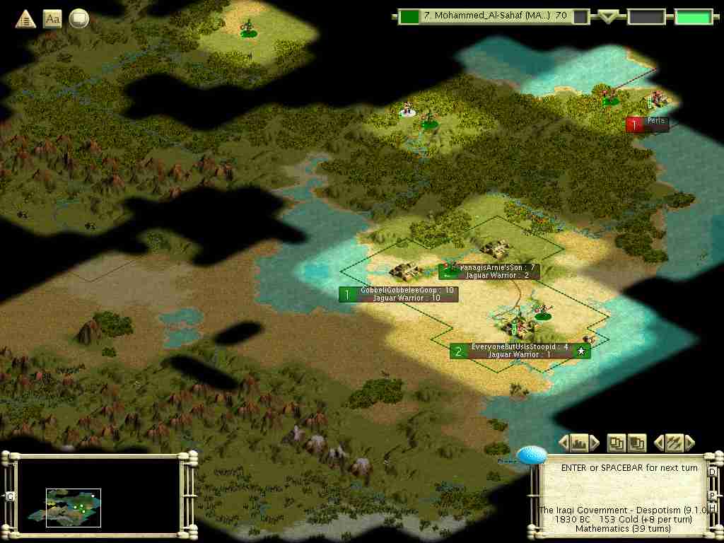

 |
|