|
| |
|
| |
|
| |
|
| |
|
| |
|

|
Az
|
 |
MACEDONIA - It's the name of the sovereign country to the north of Greece
Apr 2000
time: 07:36
|
|
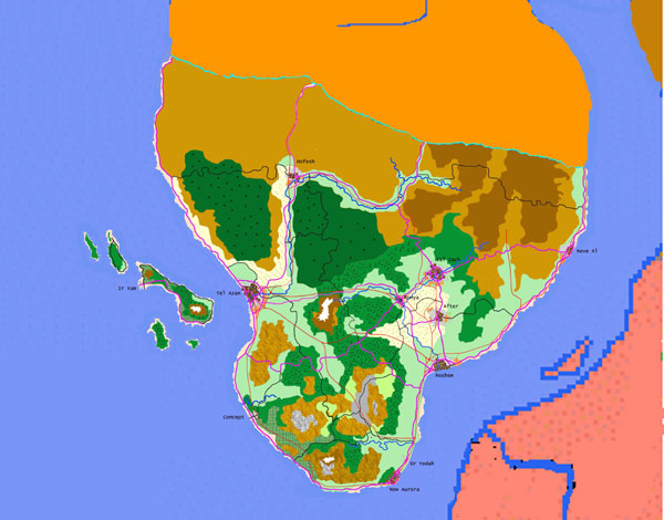
Mind you, folks, this is NOT the final map. There is yet shitloads of work to be done:
1) "rezoning" some stuff.
2) Adding more land features.
3) adding towns and villages.
4) adding small roads.
5) adding energy infrastructure.
6) adding mines, etc.
7) adding more farmland, and marking different crops that are grown there: for example, light green means that field crops are grown there. the checkered light green means that corn is grown on that land, but it Doesn't necessarily mean that there is no wheat on that land, as well .
Some more info: the little triangle without a bottom mean that it's a land where needled ( is this the right word? ) trees grow ( similar to Canada, you know? ). the triangle and circle mean a mixed forest, mediterranean, sort of. The circles and dots mean jungle. the light yellow stands for cattle growing, with twin little vertical lines means open grazing areas.
|
|
| |
|
| |
All times are GMT. The time now is 05:36.
Apolyton Time is 00:36. |
top of page
|
|
|
Forum Rules:
You may not post new threads
You may not post replies
You may not post attachments
You may not edit your posts
|
HTML code is ON
vB code is ON
Smilies are ON
[IMG] code is ON
|
|
|
|
|
|






 28-05-2004 02:32


 Attachment:


 great job... can you give us a colour key?





 Almost there, me thinks.
 Looking good, Az!
 Attachment:


 |
|