|

|
VJ
|
 |
Helsinki
Dec 2001
time: 07:25
|
|
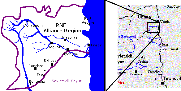
Referring to my earlier post (49) in this thread, I'll humbly ask for a slight adjustment to our map...
Please? 
 Attachment: rgt8.gif Attachment: rgt8.gif
This has been downloaded 112 time(s).
Last edited by VJ on 18-01-2003 at 15:51
|
|
| |
|
|
|
jdd2007
|
 |
Cincinnati
Aug 2001
time: 00:25
|
|
Uberlandia is a medium sized country, roughly the shape of a circle. The Capital, Clifton, is in the center. Avondale, Covedale and Hyde are the other main cities, spread evenly along the coast. The land gets less and less fertile as it goes north, away from the coastal plains. The Walnut Hills form a rough semi-circle around the capital, making some poetic-types compare this with an eye. Only one river of note is located in Uberlandia, this being the Ludlow, a looping trickle in the south. a tributary, the Milton, curves its way to Clifton.
|
|
| |
|
| |
|
| |
|
| |
|
|
|
Az
|
 |
MACEDONIA - It's the name of the sovereign country to the north of Greece
Apr 2000
time: 07:25
|
|
reposted from the Cartography thread, so Mr. President would know where to include me. 
---------------------
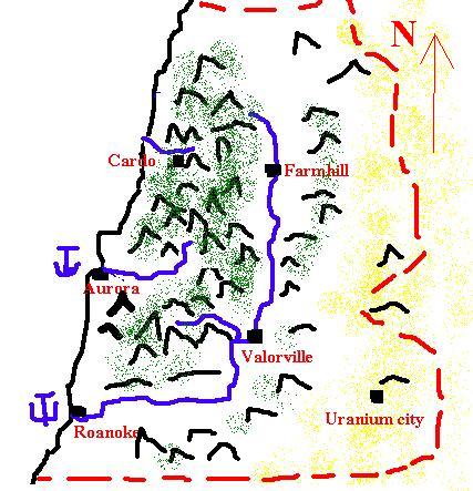
People's republic of Dark Valley:
Some general knowledge about PRDV, that I've compiled in order to give our mapmakers some meat to work with :
population: 32 million.
Capital: Valorville. pop:3,500,000.
Large cities:
Roanoke pop:2,250,000
Aurora:1,900,000
FarmHill:1,450,000
Cardo:1,000,000
The largest river is Valor.
the southernmost mountains are the North Phalgon mountains.
the big mountain mass which is in the middle is Cardo mountains.
The river on which Aurora stands is Aurora river.
The river on which Cardo stands is Egality river.
the large valley from Farmhill in the north, to Roanoke in the south west is Dark Valley.
We're located directly to the north of Tupan, and Alvis, but we don't control all of the territory betwen ourselves, and Noosland.
located in the west of apolyton.
A rough map that is drown only to give a general description of the form of Dark Valley.
 Attachment: map.jpg Attachment: map.jpg
This has been downloaded 83 time(s).
|
|
| |
|
| |
|
|
|
LDiCesare
|
|
La Ferté sous Jouarre France
Jan 2001
time: 05:25
|
|
You should include an Aegean-sea like region for islands. I fancy my Dictatorship of Azur as an island, which is not very interested in what other states do and doesn't put people in prison, inctead exiling criminals (which means throwing them to the sea, so they'd better be good swimmers).
You could say any nation not vocered is somewhere in this sea unless otherwise stated.
|
|
| |
|
| |
|
| |
|
|
|
lightblue
|
|
L'Boro, UK
Oct 2001
time: 05:25
|
|
The Free Republic of Lightblue:
Size/Location: Medium sized inland country
Climate: Equatorial
Geography: 5% (growing) built up areas, 50% Savannah/Grassland, 10% wetlands/lakes, 10% mountainous, 25% rainforest.
Major Urban Areas: Metropolitan Cambridge Area:6 million out of Lightblue's current population of 9 million life here, and all of the countries major industries (IT and retail goods are located here). The remaining people live on the grasslands which are dominated by large ranches supplying the region with top quality beef, and the recent outposts in the rainforest near the uranium mines.
|
|
| |
|
|
|
Jack_www
|
|
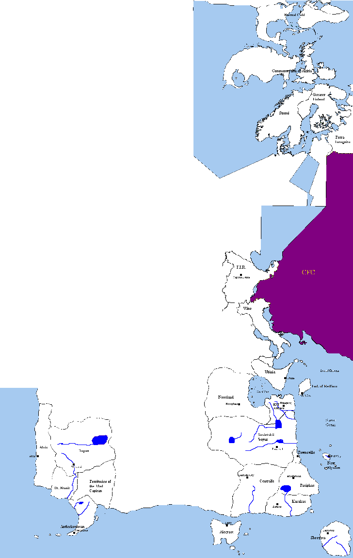
Well I am on the Coast near Sovietskii and the centrails. Can you put my country there?
|
|
| |
|
|
|
Jack_www
|
|
Also have a fast growing population too
|
|
| |
All times are GMT. The time now is 05:25.
Apolyton Time is 00:25. |
top of page
|
|
|
Forum Rules:
You may not post new threads
You may not post replies
You may not post attachments
You may not edit your posts
|
HTML code is ON
vB code is ON
Smilies are ON
[IMG] code is ON
|
|
|
|
|
|






 18-01-2003 15:22






 Pah!...




 please contact me. This is opfcourse a small verison , the bigger one is in color and too huge for this forum, I I'll post it on a website I've been making later when it's finnished.




 |
|