|
| |
|

|
Patine
|
 |
Edmonton, Canada
Mar 2002
time: 22:20
|
|
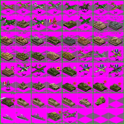
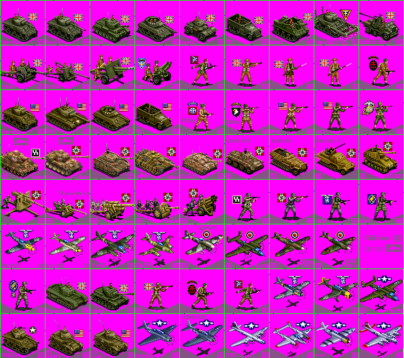
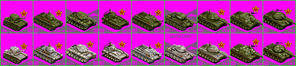
You both have a point, Curt and Steph. Events in ToT should, ideally, be able to handle the diplomacy of the 1930's (though I may need some advice with that on specific issues). I do still need the above unit graphics (I'm sorry, Erika, but your graphics are a bit dated for ToT. Thanks, anyway), so if anyone would like to get me at least some of them, I'd be most obliged. I also think I'll need a good WW2 German, Italian, British, French, and European neutral city styles (I think I saw some from Curt before the crash), I already have good US and Soviet ones from 'Empire of the Rising Sun.' If someone could help me with these, I'd be in your debt. Thanks in advance!
|
|
| |
|
|
|
Broken_Erika
|
 |
shoving your soul into a jar of mayonaise
Oct 2004
time: 00:20
|
|
quote:
Originally posted by Patine
(I'm sorry, Erika, but your graphics are a bit dated for ToT. Thanks, anyway), |
well, i'm just giving you an example, i can probably dig up the ToT versions and give the others nice ToT paint jobs,
Last edited by Broken_Erika on 16-05-2005 at 21:51
|
|
| |
|
|
|
Sarsstock
|
|
So you plan to include the Spanish Civil War in the game then? Does this mean the game will begin when the war began in the summer of 1936? Or will the game begin before this and give the Germans even more time to shore up they're forces to commit to helping the Nationalists achieve victory?
|
|
| |
|
|
|
fairline
|
 |
of the wing
Sep 2002
time: 05:20
|
|
The solution to PNG problems with IE (I think):
There's a graphics viewer program called Irfanview you can get here:
http://www.irfanview.com/
There is a plugin version of 'pngout' for irfanview which allows adjustment of png files here:
http://advsys.net/ken/utils.htm
(search for irfanview if you don't want to use the command line version of pngout. It's the pngout.DLL you want)
follow the instructions for installation of irfanview and the pngout plugin. Fire up Irfanviw and
load up the ToT bmp file you wish to convert to pngout (don't save as a png in your normal gfx program!).
Now select file-save and select PNG in the 'save as type' box. This immediately brings up an options box. Ensure the 'save transparent colour' box is unchecked. Select use Pngout plugin - this brings up another options box from which you select 'RGB' (not RGB + Alpha - it's the alpha channel that causes the problem I think.
Let's give it a try:
 Attachment: fairline tot ww2 pngout2.png Attachment: fairline tot ww2 pngout2.png
This has been downloaded 127 time(s).
Last edited by fairline on 17-05-2005 at 02:38
|
|
| |
|
|
|
Sarsstock
|
|
Well Patrick it seems you will have no shortage of excellent units from which to choose from. Do you have a rough idea of just what units you'd want to include in this scenario?
|
|
| |
|
|
|
Patine
|
|
Edmonton, Canada
Mar 2002
time: 22:20
|
|
I plan to use mostly the ones I listed above, plus some I'd already attached to the units file above. I think I'll have two units files; one, for '33 to '40, with things like Polish infantry and cavalry, Danish and Norweigan infantry, Rhineland - Austrian - Czech - Danzig garrison (and very weak unit acting only to hold cities Germany bloodlessly annexed), and the PZL P-7. These will be replaced by late war tanks and planes in the second one, under the theory they'll be eliminated from play by then. Actually, if you could get some of the infantry (Polish, Romanian, Low Countries, Italian, Danish, and Norweigan), cavalry (Polish and Soviet Cossack), and that 'anschlussed' garrison units I need (you're a good infantry and cavalry man, aren't you Chris?), I'd be much obliged. Just use the 'Demilitarized' flag you made for me for that annexed garrison's shield. Thank!
|
|
| |
|
| |
|
|
|
Patine
|
|
Edmonton, Canada
Mar 2002
time: 22:20
|
|
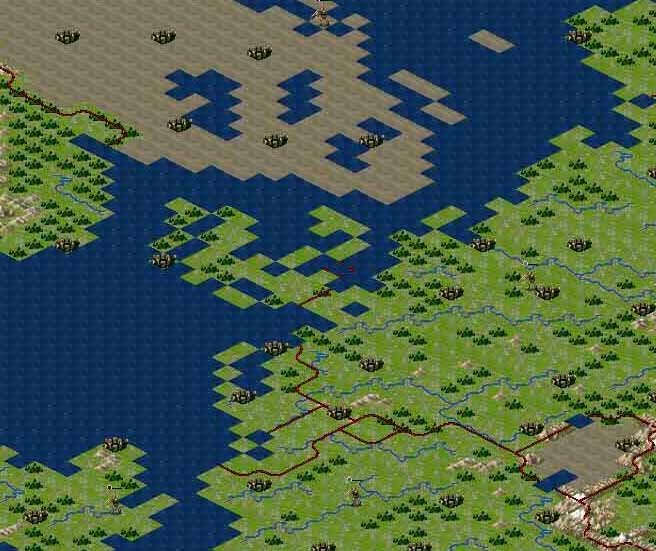
Steph, could you please make me such a map, with forest/river borders and, say, glacier neutrals (Switzerland, Sweden, Ireland, Portugal, Persia, and Afghanistan). I'd be most grateful.
|
|
| |
|
|
|
jim panse
|
 |
Anvilvania
Oct 2002
time: 06:20
|
|
It has been a little difficult to place all them borders - more or less - properly but here you go, Patrick!
Attached is a zipped file with not only the map but also with the two terrain files - feel free to alter them but leave the following terrains in their respective slots:
* The forest terrain is now the river graphics;
* The borders are represented by the river graphics - theese parts of the terrain2 file and the river mouth section should be taboo;
* The Tundra terrain has been used to add some more different graphics to the frozen regions in the north;
Feel free to alter everything - but always mind the purpose of these three terrain slots!
Oh, something else: The one-slot terrain1-file forest graphic is in the Vanilla Civ2 Glacier slot
One last sidenote: I tried my best to avoid the river mouths to make the border looks crappy - and failed in the following locations due to the (relatively) small scale of the land mass:
* Northern Ireland: place some in-game graphic there to hide it;
* Memel river mouth/East Prussia: the placed city of Königsberg should do the trick here;
* The border between Estonia & Lithuania is also a bit odd-looking, just place some in-game graphic there to hide it;
* The Libanese borders look also a bit crappy due to the shape of the coast, I hope you´ll forgive me;
* Also the Jordanian border looks a little odd I have to confess ...
* I did not include all coutries between Senegal & Liberia - too little space but I assume that border there will do too;
Known flaws:
* Albania is rather small due to the dashed shape of the land mass in southern Dalmatia though I assume that´ll do;
* The borders of the Benelux countries are done the best way the map itself allowed;
* Austria looks awful but there was simply not enough place. And that coming from an Austrian 
* Romania & Bulgaria have some kind of crappy borders too - I hope you forgive me 
* Andorra, Kuwait, Luxembourg, Belize, etc. are in - sorry, no Vatican State 
Well, that´s it I guess. Tell me if you want/need anything else altered!
Cheers, Stephan
 Attachment: scenario.zip Attachment: scenario.zip
This has been downloaded 16 time(s).
|
|
| |
|
| |
|
|
|
Arthedain
|
 |
Dúnedain of the north
Apr 2002
time: 06:20
|
|
I don't want to be too picky but here are my suggestions:
* Lebanon should belong to the Syrian mandate.
* square 71,45 (Denmark) should be grassland
* Bulgaria could be a little more to the west (the border could go through 81,81 -> 81,82 -> 81,83 -> 82.84 -> 81,85)
* Give Austria more room, the border could be 75,67 -> 75,68 -> 75,56 or maybe even end up on 74,69 (though that would look a bit odd).
* The French colonies don't need borders between them. Or what do you think? Same with the Brittish btw.
|
|
| |
All times are GMT. The time now is 05:20.
Apolyton Time is 00:20. |
top of page
|
|
|
Forum Rules:
You may not post new threads
You may not post replies
You may not post attachments
You may not edit your posts
|
HTML code is ON
vB code is ON
Smilies are ON
[IMG] code is ON
|
|
|
|
|
|





 16-05-2005 20:55


 Attachment:

 |
|