 |
| |
|

|
Tingkai
|
|
To find the Northwest Passage
Aug 2001
time: 13:27
|
|
quote:
Originally posted by cinch
Well, Labrador as a whole certainly wasn't part of the Dominion at its inception (1867):
The southern part of Labrador *was* originally part of Quebec, though, as you can see (if the picture shows).
And, apparently, most of Labrador (save for the extreme coast?) was part of Quebec or the NWT until 1949:
None of that really matters, though, because on the globe, Newfoundland is the same colour as Canada, while Labrador is not. That's just plain silly. |
There was a dispute back then about who actually controlled Labrador. Quebec claimed a large chunk of it, as the maps you posted showed. The boundary dispute ended with Nfld entering confederation, however it is common for Quebec maps tol show Labrador as being part of Quebec.
This globe may have been produced at the end of '48 when Nfld was joining Canada, but before all the details were ironed out.
Maybe Flubber can help us out. I think he's a Newf.
|
|
| |
|
|
|
Straybow
|
 |
SG(2)… gone but not forgotten
Jan 1970
time: 23:27
|
|
Ned, you have a point about "World" Bank. I still say post-WWII. But since most of Africa is still British, French, and Belgian; Germany is not officially divided; it is quite shortly after WWII.
Last edited by Straybow on 02-05-2003 at 10:38
|
|
| |
|
|
|
Straybow
|
|
SG(2)… gone but not forgotten
Jan 1970
time: 23:27
|
|
The war between Ecuador and Peru was 1925, and Peru took almost all of Ecuador's Amazon possessions (about half of Ecuador's territory). Looks like this is after Ecuador took some of it back. There may have been a third war, but my S. Am. history is sketchy after 20+ years.
Last edited by Straybow on 02-05-2003 at 10:42
|
|
| |
|
|
|
Dr Strangelove
|
|
All that we can say is that it is a truly crappy map. Sudan being "Anglo-Egyptian" dates the map as being pre-1950s, prior to Gamel Nassar coming to power. Could the map have been designed somewhere around 1949 to 1954, i.e., after the birth of Israel?
|
|
| |
|
|
|
Locutus

|
|
ACS CTP1/2 Manager & Civ4 Co-Manager
|
 |
Hengelo, The Netherlands
Nov 1999
time: 06:27
|
|
Considering the situation regarding Ireland, St Petersburg and Ankara, it's safe to say this globe is from the mid/late 1920s at the earliest. Add to that that the names (Nora/)Nova Lisboa, Angola (1928) and Yugoslavia (1929) appear on it, and the 1930s become more likely as earliest date.
Since Iran was commonly known as Persia until 1935 and Japan controlled Manchuria from 1931 onwards, it seems unlikely that it's from the 1930s. Not to mention the fact that the Baltics are part of the Soviet Union, while Finland is independent (so can't be pre-WWI either).
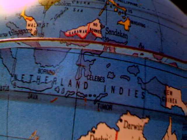
Indonesia is still Dutch, Newfoundland not yet part of Canada, Thailand is still known as Siam and Beijing as Peiping, so the latest year this globe could be from is 1949.
Since India is still unified (and has the same color as most other British colonies) and Jordan is still known as Trans-Jordan, this globe is most likely from 1946. The only things which contradict this are the mention of Israel (>1948) and Tannu-Tuva (<1944), but the explanation for that could be that there was a lot of uncertainty on those issues in the first years after WWII. Especially since Palestina and Israel appear to refer to the same territory, this seems a plausible explanation (unless Israel refers to Cyprus  ) )
|
|
| |
All times are GMT. The time now is 05:27.
Apolyton Time is 00:27. |
top of page
|
| archivepost |
|
Forum Rules:
You may not post new threads
You may not post replies
You may not post attachments
You may not edit your posts
|
HTML code is ON
vB code is ON
Smilies are ON
[IMG] code is ON
|
|
|
|
|
|






 02-05-2003 09:59


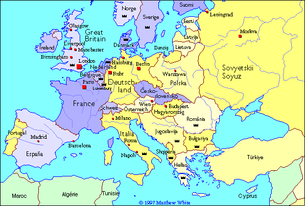
 As it seems my thread may be winding toward its end I will share with you the last two interesting bits of my globe and may you all have a good night...




 |
|